Blog
Mt. Akadake Two-Day Traverse, Part 2 | Sunrise, the Yokodake Ridge and the Blast Crater of Mt. Iodake
2025.07.26
Day one was rain and cloud from start to finish. We got through it, spent the night at Akadake Tenbo-so, and woke up to the reward on the other side of all that: a view I couldn't have imagined.
Part 2 covers the sunrise, the rock ridge of Mt. Yokodake with its run of chains and ladders, and the enormous blast crater of Mt. Iodake. This is the day Yatsugatake showed us its real face. If you haven't read Part 1 yet, start there.
Route overview (day 2)
- Route: Akadake Tenbo-so → Mt. Yokodake → Mt. Iodake → Akaiwa-no-atama → Akadake Kosen hut → Kitasawa route → Minotoguchi
- High point of Yokodake: Okunoin (2,829 m)
- Difficulty: ★★★★☆ (intermediate to advanced). Rock sections, fixed chains and ladders come one after another, so you need solid three-point contact technique and to be comfortable with exposure
- Essential gear: Helmet, rain shell, warm layer, headlamp. The weather on the ridge changes fast, and full kit is the baseline
Sunrise from Akadake Tenbo-so — a sea of cloud and Mt. Fuji
The summit of Akadake had been solid white the day before. But when the night ended at Akadake Tenbo-so, which sits at 2,722 m just below the summit, a sea of cloud stretched out in front of us.
The morning sun turned it gold, and far off was the silhouette of Mt. Fuji. That was the moment I understood why people stay overnight: you get the evening light and the morning light out of the same trip. We'd booked the hut because we'd heard the ridge here was beautiful. This view alone made it worth coming.
The Yokodake rock ridge — chains, ladders and Okunoin
Once we'd had our fill of the sunrise, helmets on and day two began. We went over Jizo-no-atama and into the steep, beautiful rock ridge that runs toward Yokodake. It genuinely felt like walking a path above the clouds.
On rock as narrow as a razor's edge, the thing you trust is a single chain, with a valley below that feels ready to swallow you. Three points of contact, one careful step at a time. As on Akadake the day before, I was very glad I'd taken a rock-scrambling course beforehand. Just knowing where to put your hands and feet takes a lot of the fear out of it.
Yokodake has an interesting story attached. Its high point is Okunoin (2,829 m), but for years the maps gave that title to a different peak. Plenty of hikers felt Okunoin looked higher, and eventually improved surveying confirmed it as the true summit. Years of accumulated instinct backed up by modern measurement — I rather like that.
Komakusa, and the ridge in the sky
Past the rock, alpine plants appear along the ridge, including a protected growing area for komakusa (Dicentra peregrina), the flower often called the queen of Japan's alpine plants. They were only just starting to open when we passed, with the full bloom still ahead. Another reason to come back.
The weather kept changing all day. Thick white cloud one moment, a gap of blue the next. One of the hut staff told us it's rarely clear all day or cloudy all day here, and that matched what we saw. On this ridge you need to be ready for sun and for cold and rain, in the same hour.
Mt. Iodake — a huge blast crater and a plateau in the sky
Beyond Yokodake is Mt. Iodake, a mountain with two completely different faces.
The first is the vast blast crater: the ground torn open, sheer walls exposed, a raw reminder of what this volcano once did. Then you step past the rim and the world changes. A calm, open plain spreads out in every direction — the broad flat summit that people here call the plateau in the sky.
That gentle summit has a catch, though. In fog, it's a place where you can easily lose the path. What saves you is the cairns, the stacks of stone left by the hikers who came before. Following them one to the next, we always knew which way to go even inside the cloud. A mountain where danger and reassurance sit side by side, and one I won't forget.
Down to Akadake Kosen — ramen and the Kitasawa trail
We waited on Iodake for a break in the cloud, took in the view properly, and started down. Over Akaiwa-no-atama and on to the Akadake Kosen hut, where a hot bowl of ramen fixed most of the tiredness.
From there the Kitasawa route follows a stream past waterfalls. Walking with the sound of water alongside you is lovely. Light rain caught us again at the end, but by then I felt like we'd had enough rain on this trip that a bit more wouldn't bother me next time. Past the junction of Minamisawa and Kitasawa, then about 45 minutes on the road back to Minotoguchi, and two days that felt much shorter were over.
Final thoughts: the Yatsugatake I'd wanted to see
I'd wanted to walk Yatsugatake for a long time. Part 1 was rain and cloud, but Part 2 gave us sunrise over a sea of cloud, a thrilling rock ridge and the sheer scale of the Iodake crater — the mountain's real face. Honestly, I came away understanding why people want to string two or three nights together up here.
With rock, chains and ladders in sequence this is a ★★★★☆ intermediate-to-advanced route, so a helmet and other proper gear are essential and so is three-point contact technique. If you can take a rock-scrambling course first, do. The southern Yatsugatake traverse including Akadake is also a good step up if you're working toward the Japanese Alps.
Related posts

Mt. Akadake Two-Day Traverse, Part 1 | Minotoguchi to Bunzaburo Ridge and the Summit of the Yatsugatake

A Complete Guide to the Koboyama Hike | Hadano Station to Tsurumaki-Onsen Station, Three Gentle Hours with Binoculars

The 5 Mountains That Stayed With Me This Year | Nokogiriyama, Bukosan, Akadake, Hirugatake and Mount Fuji
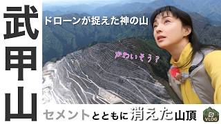
Mt. Bukozan Day Hike | The Omotesando Route in Chichibu, the Famous "Water Carry", and an Honest Look at a Mountain Being Quarried Away
Work with me
I produce video and wear-test content for outdoor, hiking gear and apparel brands. Enquiries in English are welcome.
Get in touch →