Blog
Myojogatake and Myojingatake Day Hike | A Beginner's Guide to the Hakone Outer Rim Loop from Gora
2024.07.13
Look a little above Hakone, the hot-spring town, and you'll see a gentle line of peaks along the skyline. That's the Hakone outer rim — the ring of mountains around the caldera. This is a day loop over two of them, Myojogatake (924 m) and Myojingatake (1,169 m), linked along the ridge and walked from Gora Station.
The short version: this route is reachable by train and bus, has very little dangerous rock, and still gives you a proper day's walking — which makes it a good step up for a beginner. That said, at roughly 11.4 km it's long for a low mountain, and in summer, managing the heat is essential. Here's the route in full, how to reach the trailhead, and what I did to walk it safely on a hot early-summer day.
The two names are nearly identical but they're entirely separate peaks. They get confused often, so if you've ever wondered what the difference between Myojogatake and Myojingatake actually is, this should clear it up.
The route in outline (Hakone outer rim, a loop from Gora)
- Area: the Hakone outer crater rim (Hakone, Kanagawa Prefecture)
- The two peaks: Myojogatake (924 m) and Myojingatake (1,169 m, the high point of this route)
- Route: Gora Station → Miyagino → Myojogatake trailhead → Myojogatake → ridge junction → Myojingatake → back to the junction and down toward Miyagino (a loop)
- Access: start from Gora Station, the terminus of the Hakone Tozan Railway. You can get back on public transport from the bus stop at Miyagino afterwards
- Distance: about 11.4 km
- Cumulative ascent: about 999 m (substantial for a low mountain)
- Standard time: about 5 hours 44 minutes (an unhurried pace, including breaks)
- Difficulty: ★★☆☆☆ (beginner to lower intermediate). Few genuinely hazardous sections and the trail is easy to follow, but the distance is long and in summer it becomes a contest with the heat
The Hakone outer rim also includes better-known peaks such as Kintokiyama, Hakone Komagatake and Kamiyama. Myojogatake and Myojingatake are relatively quiet by comparison, which is exactly what makes the ridge walking so pleasant.
Up at 3 a.m., walking at 6 — how to hike a low mountain safely in early summer
The thing I most want to pass on from this day is the decision to start early.
I walked it in early summer. Even so, the low ground around the Hakone trailheads gets as hot and humid as anywhere on the plain. So I got up at 3 a.m., travelled out, and was walking by 6. The reasoning is simple: climb before the temperature peaks, and be back down early. On a low mountain in summer, the real danger isn't the rock — it's heatstroke.
In practice this was exactly the right call. Even so, by just after 7 the sweat wouldn't stop, and I said out loud more than once that low mountains in summer really are hot. Had we started around midday, the heat would have drained us quickly. If you're planning a low mountain in summer, shift your whole day earlier. I'd say that as loudly as I can.
From Gora Station to Miyagino, and on to the Myojogatake trailhead
The start is Gora Station, the end of the Hakone Tozan Railway line. From there we took a shortcut down a steep road toward the Miyagino bus stop, beside the river.
From the Miyagino bus stop to the trailhead is a stretch of asphalt and concrete. That paved climb is steeper than you'd like, and it starts working on your legs before you're even on the trail. At 7:05, picking out the shade as we went, we were already soaked. We nearly walked straight past the entrance, but found the Myojogatake trailhead in the end. From there the proper mountain path begins.
Shortly after starting up, we met our first resident in the trees: a tanuki (Japanese raccoon dog). It was the first wild animal I'd seen that day, and it lifted spirits that the heat had started to flatten. Small surprises like that are part of the reward for being out early.
Myojogatake (924 m) — the Hakone peak behind the daimonji fire
We sweated our way up the steep section and arrived at the first summit, Myojogatake (924 m), one of the peaks that make up the Hakone outer rim. A pause here, first.
Myojogatake has a rather interesting history. It's among the older parts of the outer rim, formed somewhere around 270,000 to 350,000 years ago. The name is said to come from its position: seen from the direction of Odawara it lies due west, in the direction where Venus, the evening star — *myojo* — shines.
Its other identity is the alternative name Daimonjiyama. Each summer, the daimonji fire festival lights up the night sky over Miyagino in Hakone, with the character 大 ("great") burning on the flank of this very mountain. Knowing that a hill you've looked at casually is the stage for a seasonal festival makes it feel considerably closer.
Along the ridge to Myojingatake (1,169 m)
From Myojogatake we backtracked to the junction and followed the ridge toward the next objective, Myojingatake.
Myojingatake is 1,169 m — the high point of this route, and about 250 m higher than Myojogatake. One character apart in the name, but on the ground they're clearly different mountains, in position and in feel. Following the outer rim and gaining height gradually, this is the best traverse section of the day.
The area around the summit of Myojingatake is known for open ridge with the trees pulled back and a wide field of view. Kintokiyama on the same rim, and — if the weather cooperates — the view out toward Mt. Fuji: the sort of panorama Hakone does well. It's the place where the effort of getting there is repaid.
Down to Miyagino — closing the loop
Having stood on the summit of Myojingatake, we returned along the ridge to the junction and descended toward Miyagino. Rather than retracing the whole climb, the loop brings you back near where you started, so the views out and back are different.
The descent can feel long in places, but thanks to the early start we had time in hand and were off the mountain before the heat really set in. Starting early and finishing early pays off exactly here.
Difficulty, and advice for beginners
Some practical points for anyone about to walk it.
- It's long: about 11.4 km with roughly 999 m of cumulative ascent — a full day's walking, low mountain or not. If you're used to something like Takaosan, this is about the right size for a next step.
- Manage the heat above all: in summer, moving your start time earlier is the single biggest safety measure. Carry plenty of water, take salt, and rest often. There's a stretch of paved road with little shade early on, so a hat and sun protection matter.
- The trail is easy to follow: few chains or serious rock, and little risk of losing the path. Even so, checking your position on a map app as you go is reassuring.
- Reachable on public transport: starting at Gora and descending to Miyagino means the whole thing works by train and bus, with no car to go back for.
What I've settled on: two similar names, one continuous line
Myojogatake and Myojingatake. The names are one character apart and easy to muddle, but walk them and they're plainly two different mountains: the historic 924 m Myojogatake, stage for the daimonji fire, and the 1,169 m Myojingatake with its view across the outer rim.
Linking the two in a single unbroken line from Gora is what makes this route satisfying. With few hazards, the challenges are distance and heat — which is to say that if you solve those in the planning, a beginner can have a genuinely rewarding day out here.
Hakone tends to bring hot springs and Lake Ashi to mind, but walking the outer rim that forms its backbone shows you a completely different face of a familiar place. Make an early start your ally, and go and walk the ridge between Myojogatake and Myojingatake.
🛒 See the gear from the video as a list → A packing list for your first low-mountain hike
※As an Amazon Associate, Yoshimi Iwasaki earns from qualifying purchases.
Related posts
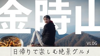
Kintokiyama Day Hike | A Hakone Loop to Otome Pass, with Mount Fuji Views and the Famous Summit Teahouse

5 Low Mountains Near Tokyo With Big Views, All Reachable by Train

Why Montbell's Wickron T-Shirt Is Hard to Beat | 4 Honest Reasons It Handles Sweat, Odour and Years of Washing

Hokendake and Kisokomagatake | A Two-Day Traverse of the Central Alps from Senjojiki Cirque
Enjoyed this? Subscribe on YouTube.
Honest reviews of hiking gear and apparel, plus hiking vlogs from Japan — new videos every week.
▶ Subscribe on YouTube →Brands: for video production and wear-test enquiries, get in touch →